|
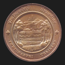
Phetchaburi (เพชรบุรี)
Thai. Capital city of the
jangwat Phetchaburi,
as well as a province (map) of the same name,
located on the Gulf of Thailand. The city has a population of approximately 35,000 and is situated 123 kms to the South of
Bangkok in West Thailand.
Being a former royal city, Phetchaburi has an old history, dating back to the
Mon of the
8th century. Later, the
Khmer settled
here, bringing some architectural influence to the city, which is still visible
today in the
prang
of Wat Kamphaeng Laeng. In 1860, King
Mongkhut
had a palace built in the vicinity of the city, complete with an adjacent
tower for his astronomical observations. The city's and province's places of interest include the underground temple cave Tham Khao Luang (map - fig.) which houses a Buddhist shrine illuminated by falling sunlight (map
- fig.), Mon Thep Nimit Buddha Pond (map - fig.), Sala Taeng Ngae (map - fig.), Tham Khao
Yoi cave (map
- fig.), the King Mongkhut Memorial Park (map - fig.) featuring with the royal field
Sanam Luang (fig.), a large monument of this monarch (map - fig.) and the
City Pillar (map - fig.), and Khao Wang (fig.), the
‘palace mountain’ with the remains of King Mongkhut's Summer Palace (map
-
fig.) and a beautiful view over the area (fig.). The province has several beach resorts, including the popular resort of Cha-am, and Kaeng Krajahn National Park, with about 2,919 kms² the largest in the country covering almost half the area of the province
and with wildlife that includes
Dusky
Leaf Monkeys (fig.). The province has eight
amphur.
The province is also called Phetburi and the city is often referred to as Meuang Phet.
See also
Phetchaburi data file.
回


|