|
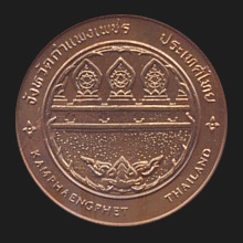
Kamphaeng Phet (กำแพงเพชร)
Thai. ‘Jewelled wall’ or ‘diamond wall’. Historical capital of a
contemporary province (map)
of the same name in North Thailand. The city has app. 24,000
inhabitants and is situated 358 kms North of
Bangkok. The city was once an important outpost of
Sukhothai, and a buffer against attacks from
Burma. Its name
stands as a symbol for the history of this
principality, which served as a ‘wall
(kamphaeng) as hard as a diamond (phet)’,
preventing the enemy to go beyond it.
It later became an outpost of
Ayutthaya.
Geographically it is located in the lower North on the bank of the
Ping river. River flats make up much of the
East of the province, whereas the West consist of mostly mountains
covered with forests. Its
places of interest include the
remains of the old city and its wall, a historical park and a
national museum.
Kamphaeng Phet Historical Park
(map
-
fig.)
is situated on the east side of the
Ping
river,
dates from
the late
Sukhothai to
early
Ayutthaya period
(14th
to 15th century AD),
and covers an area of 3.4 square kilometers.
It comprises some 60 separate historical
sites and
structures. It is divided into two sections, namely the
city of Kamphaeng Phet itself, which lies within the ancient
city walls, and a portion known as Aranyik (อรัญญิก),
which lies in the forest outside the northern walls.
The national historical park was included on the UNESCO
World Heritage List on 12 December 1991 and appears on a set of
four postage stamps issued in 1996 to commemorate the annual
Thai Heritage Conservation Day
(fig.). The region
of
Kamphaeng Phet is known for the cultivation of
gluay khai, a banana (gluay
or
kluay)
shaped like an egg
(khai), which among other fruits and foods can be found on the
Cha Kangrao Night
Bazaar (fig.). The province has nine
amphur and two
king amphur, 78
tambon and 823 villages,
known as
mu ban.
See also
See also Kamphaeng Phet data file.
回


|