|
Loei (เลย)
Thai. Name of a Thai province as well as of
its capital city (map),
which is located 520 kms North of
Bangkok and situated in the far Northwest of
Isaan,
and wirh a population of around 22,000.
In the North it borders the provinces Xaignabouli and
Vientiane of
Laos. The region is known for its cotton industry and its National Parks, including the 349 kms² large Phu Kradeung National Park, with 1,360 meters the highest
point in the province and with around 50 kms of marked hiking trails. The park allegedly has elephants, tigers, gibbons and black bears. Other National Parks are
Phu Reua NP with around 121 kms² and the less visited Phu Luang NP. Annually, in mid-June, Dahn Saai district celebrates the unique
Phi Tah Khohn festival.
There is historical proof that Loei was first inhabited by
Poh Khun Bang Klang Haw (บางกลางหาว)
and Poh Khun Pha Meuang (ผาเมือง), generally believed to be descendants of the
lineage of the Singhnawat Dynasty (สิงหนวัติ), a Thai tribe whose ancestors
earlier founded the
Chiang Saen kingdom of
Yonok. They resettled from Yonok after it
had failed, migrating through the territory of
Lan Chang
and crossing the Heuang (เหือง) river, into the flatlands, to the right of the
Man river (หมัน).
Pha Meuang built a village on the ‘right side’ of this river, in the area
which today is Chai Neun Dan Khwa (Dan Khwa literally means the ‘Right Side’),
whilst Bang Klang Haw moved along the Man river and founded Ban Nong Kuh (บ้านหนองคู)
on the ‘left side’ of this river, in the present-day area of Kao (เก่า)
village. They they later renamed Ban Nong Kuh as Dan Saai (ด่านซ้าย), literally
meaning the ‘Left Side’. Today, the ruins of an ancient temple in a private
field in between the village of Hua Laem (หัวแหลม) and Na Bia (นาเบี้ย) in the
amphur Dan Sai, are witness of this early occupation. In 1853 AD king
Mongkut
upgraded the village of Hae (แฮ่), located on the banks of the
Mahn creek and in the vicinity of the river
Loei, to better administer the
increased population in the area, thus founding the city which would later be
named Loei. In AD 1897 the area was split up into three
administrative subdivision
by royal degree, i.e. the
amphur Kut Pong (กุดป่อง), amphur Tha Lih and amphur Nakok (นากอก), of which Kut
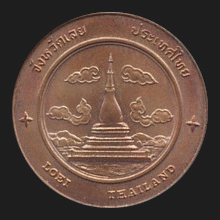
Pong (fig.) was made the capital city and the latter today belongs to Laos. The name Kud Pong was changed several times, first into Loei River Area, than
Heuang River Area, but finally on 4 January 1907 it
officially became known as Meuang Loei. The province has twelve
amphur and two
king amphur,
and its places on interest include
Wat Somdet Phu Reua Ming Meuang (fig.),
Wat Neramit
Wipatsanah (fig.),
the
Phi Tah Khohn
Museum (fig.),
Suan Hin Pha Ngam
(fig.),
Chiang Khan Skywalk (fig.),
etc.
See also
Loei data file.
回


|