|
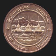
Kanchanaburi (กาญจนบุรี)
Thai. ‘City of gold’. A provincial capital of app. 37,000
inhabitants in West Thailand, 128 kms from
Bangkok, in a province (map)
of the same name and initially founded by
Rama I as a first defensive buffer against attacks from Burma
which it borders in the West with the Kayin State, the Mon State and
the Tanintharyi Division of
Myanmar.
Archaeological discoveries in this area date back to the 4th century
AD confirming that trade with neighbouring peoples already existed
here during that time. The province has also been under
Khmer influence, but little is known about
that period. The area is famous for its bridge over the River
Kwae Yai (map -
fig.)
and the construction of the railway along the River Kwae Noi (map
- fig.), connecting Bangkok with Rangoon,
built during WW II by the Japanese occupying forces with the aid of
forced labour namely POWs and native workers. Because of the high
death rate during construction -it is said one life for each
sleeper- the railway was named the
Death Railway (fig.).
The events of WWII are remembered annually in the festival of the
Week of the Bridge over the River Kwae
(fig.),
during which in the evening a daily spectacular sound and light show
is staged at the bridge (fig.).
A number of the victims were buried locally in the war cemeteries
Don Rak (fig.)
and
Chong Kai
(fig.).
The district of Phanom Thuan is
celebrated for Ram Yoei, a local 500 year-old dance in which one
person leads in singing with another replying to his lyrics, whilst
men and women dance in a circle.
In this
jangwat (fig.)
there are plenty of
places of interest, including the temples
Wat Tham Seua (fig.),
Wat Ban Tham (map
-
fig.),
Wat Tham Khao Noi (fig.),
the
Rama III
Monument at the City Gate (map
-
fig.) near
the
City Pillar
Shrine
(map
-
fig.), the
Thailand-Burma Railway Centre (fig.),
the
Hellfire Pass Memorial, a
Thai
History (fig.) and
WW II Museum (map
-
fig.),
Khao Laem reservoir (fig.), the
Tha Thung Na (map
-
fig.)
and
Sri Nagarindra
dams (map
-
fig.), the town of
Sangkhlaburi
(fig.)
with the country's longest wooden bridge (fig.),
Wat Wang Wiwekaram
with its
pagoda built in the style of the Mahabodhi
pagoda of
Bodhgaya (fig.),
several caves, such as
Tham
Krasae (fig.) with its
remarkable rock
formations (fig.),
the infamous
Tiger
Temple (fig.),
the
King
Rama I
Statue at
the Phra
Phutta Yotfa Camp of
the
13th Border Patrol Police
Department (fig.),
The Nine Army Battle Historical
Park (fig.), and the
Three Pagoda Pass (fig.). There are also several National Parks
and waterfalls including those of
Erawan National Park, Sai Yohk NP (vdo),
with the waterfalls Sai Yohk Lek (vdo,
fig.),
Sai Yohk Noi (vdo1,
vdo2,
map
-
fig.),
and Sai Yohk Yai (fig.); and Sri Nakharin NP, and
different historical places, such as
Prasat Meuang Singh (fig.)
and Ban Kao. This province has 13
amphur, 98
tambon and 887 villages or
mu ban.
Both the city and province are also known by the short name Kan.
See also
Kanchanaburi data file.
回


|